Remnants of a Pre-Contact Structure at EaKa-34
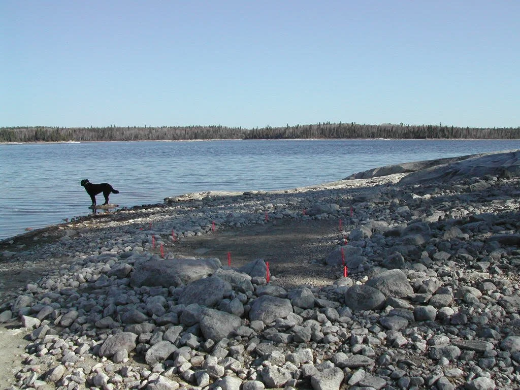
Back in the early spring of 1991, I was exploring stretches of exposed shoreline on Lac Seul searching for any artifacts that had possibly been uncovered from within the eroded and recirculated lake soils. I made a random stop at an island that, although mainly bedrock, had a small sand and cobble section extending as a gently sloping plateau along the west side of the island. While looking within the cobbles situated near the bedrock at the highwater mark, a notched projectile point made from Hudson Bay Lowland (HBL) chert was discovered.
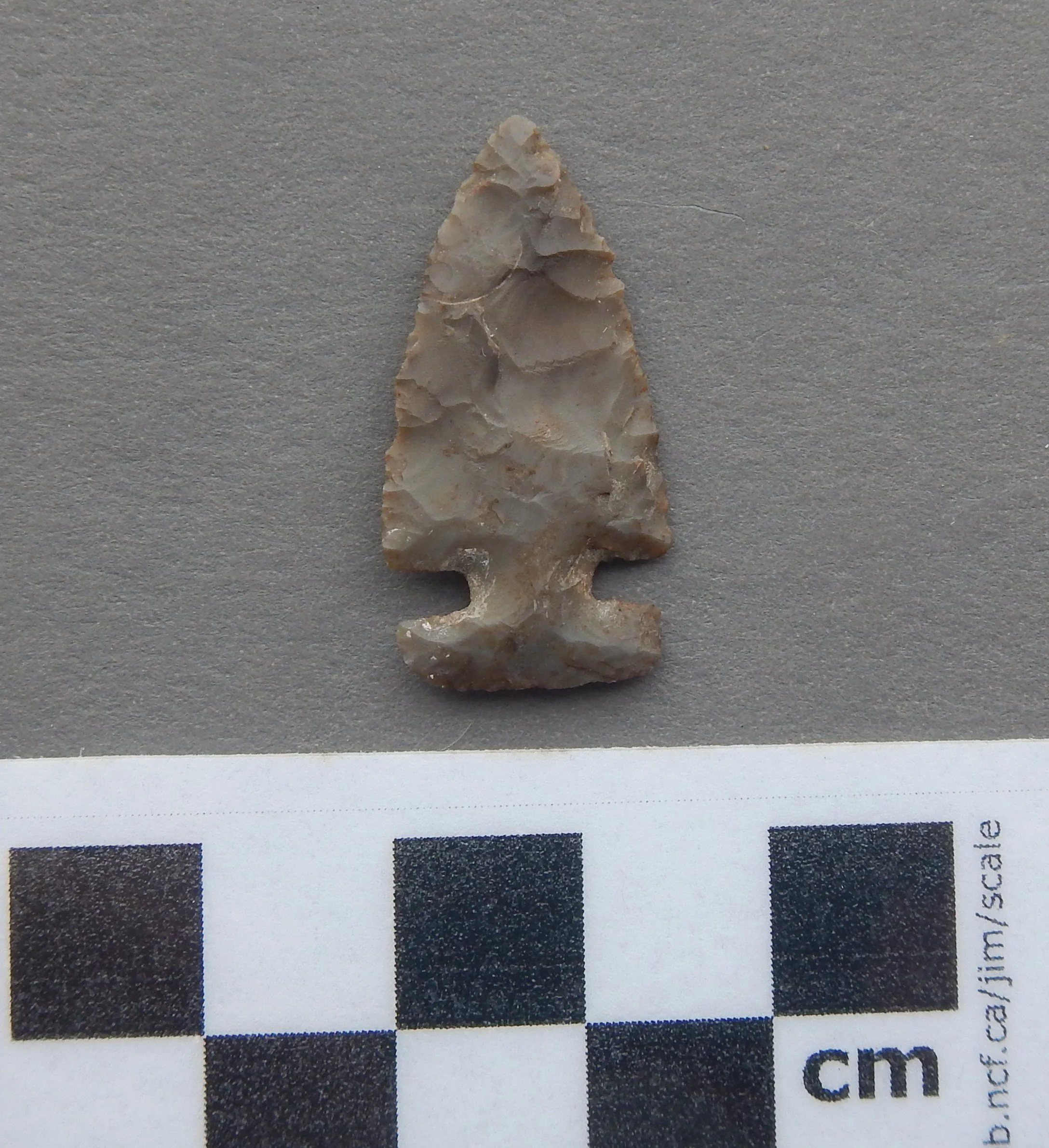
Side notched HBL chert projectile point
The point is quite small in size with well defined side notches that were made and placed along the blade in such a way that the base portion of the projectile point looks rectangular in shape. Within the vicinity of this discovery, three stone flakes and another artifact (a possible tool of unknown use) were also found.
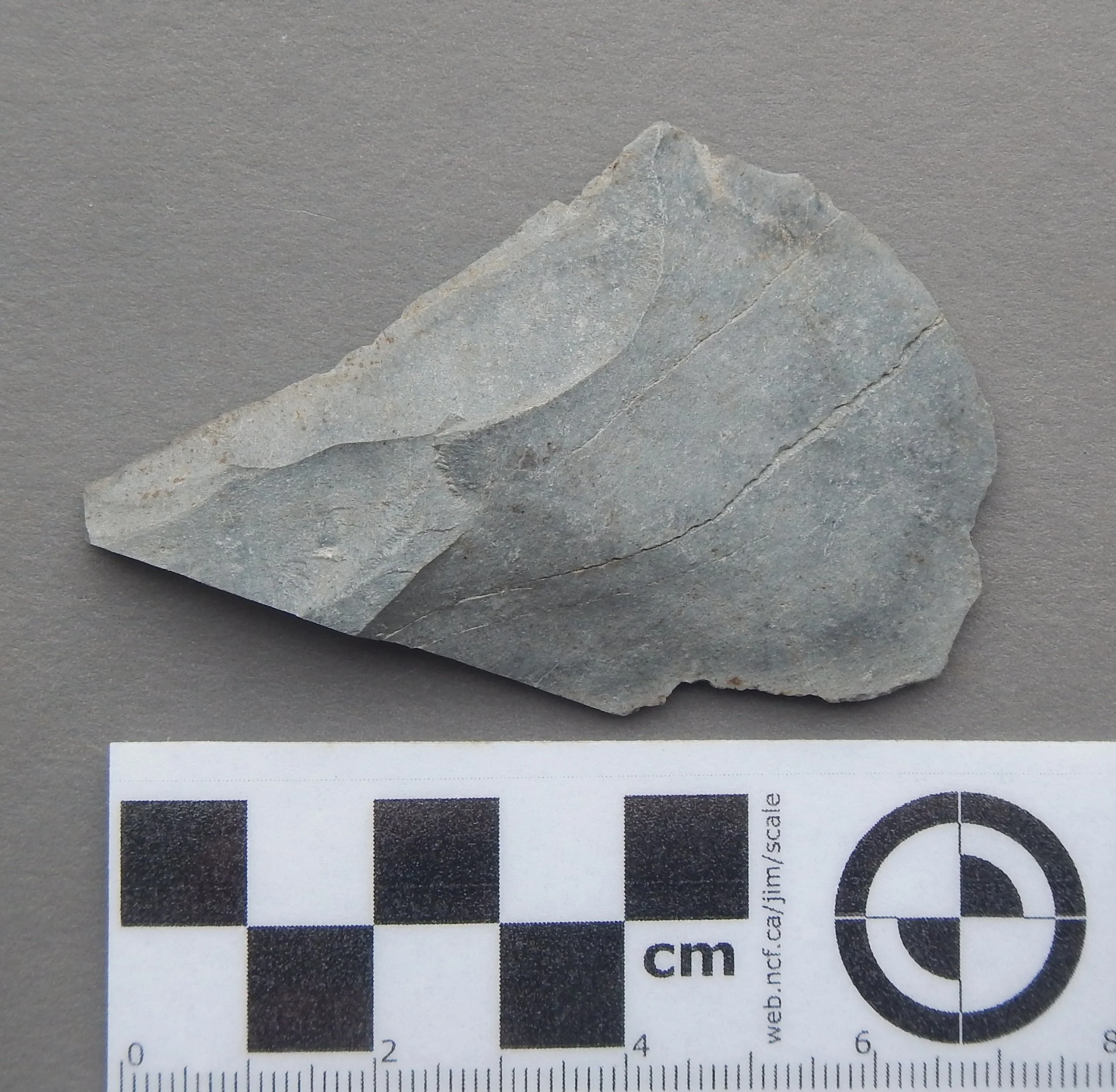
Larger sized rhyolite flake recovered from the site

Flaked rhyolite tool (unknown tool)
I then proceeded to search along the waterline as well as into the shallow sand bar area that was under water. Walking through the water in hip waders, I noticed a completely black rock that appeared to be a perfect rectangle at a depth of about 18 inches,. Thinking that this was an unusual shape for a rock I put my hand into the very cold water and reached for it. As I lifted the rock up and out of the water to get a better (closer) look, I was surprised to find that an amazing discovery had just been made. Embedded within the soils and submerged beneath the water, I had just recovered a tool classified in the literature as a “grooved gouge”. A detailed description along with pictures of the grooved gouge recovered can be found in the cool discoveries section of this website or be viewed by clicking this link. Although few in number, the artifacts recovered from this island identified it as an archaeological site. A new site form was registered with the Ontario Ministry and it was designated as EaKa-34.
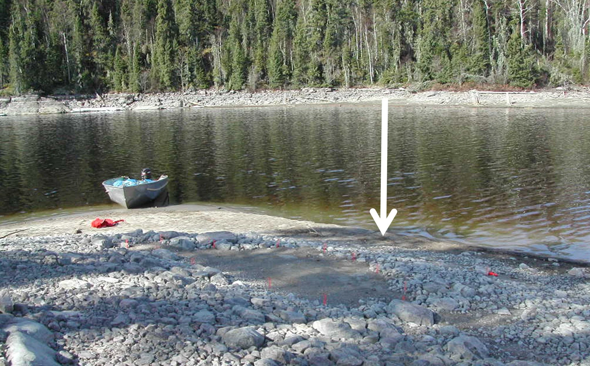
Pictures of the site were taken in order to document the approximate location of the discovery. Of course, 1991 was within the “pre-digital camera” era when photographs were shot on film that had to be taken to a store or sent away for development at a later date. The pictures I took on this day were recorded on Kodachrome 64 slide film which was not developed until later on in September. So, several months after the recoveries were made, I had my first chance to examine the photographs taken at the site that day. I noticed that within the area of cobbled rocks, that stretched along the shoreline close to where the grooved gouge was located, there was a section of bare ground that was elongated and roughly ovate in shape.
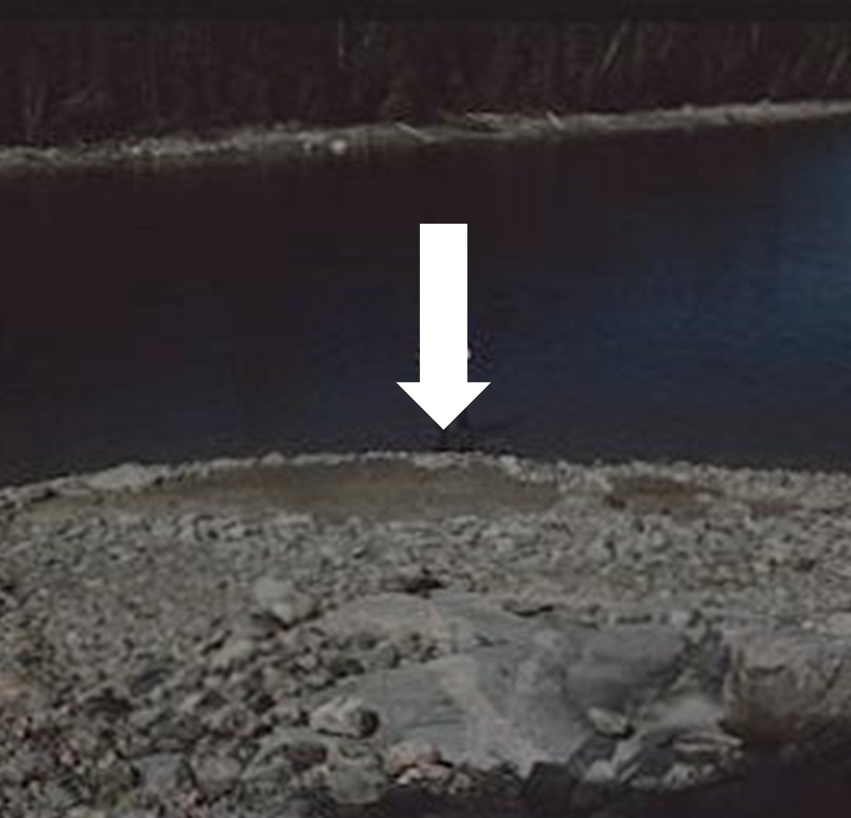
White arrow indicates approximate location of grooved gouge discovery
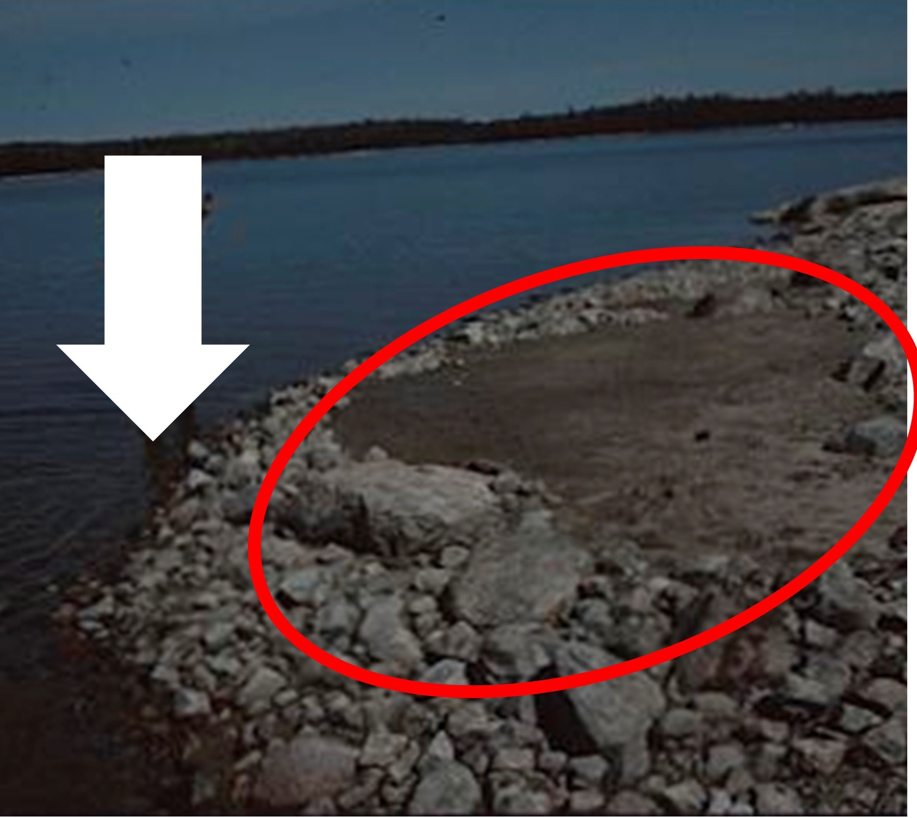
Red circle indicates oval shaped clearing within the cobble shoreline
This caught my attention for a couple of reasons. First of all, why had I not noticed this very obvious peculiarity back in May when I was physically at the site? Second of all, the “cleared” area within the heavily cobbled section of ground had a distinct oval to ovate shape. It reminded me of a series of illustrations within a 1989 Canadian Museum of Civilization publication (“Ancient Canada” by Robert McGhee: pages 56 and 57) that portrayed a similar rocky outline as the possible remains of a structure (redrawn sketches from that book are below)
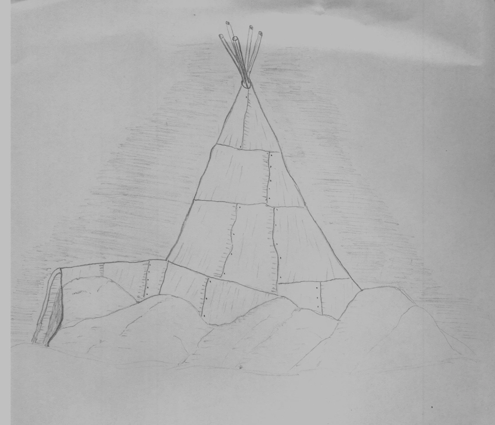
Redrawn image of a possible sub-arctic winter structure
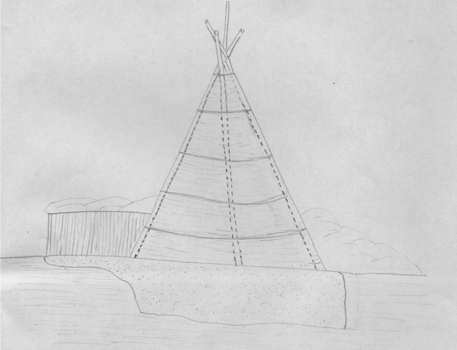
Redrawn image of possible semi-subterranean winter structure (elevation view)
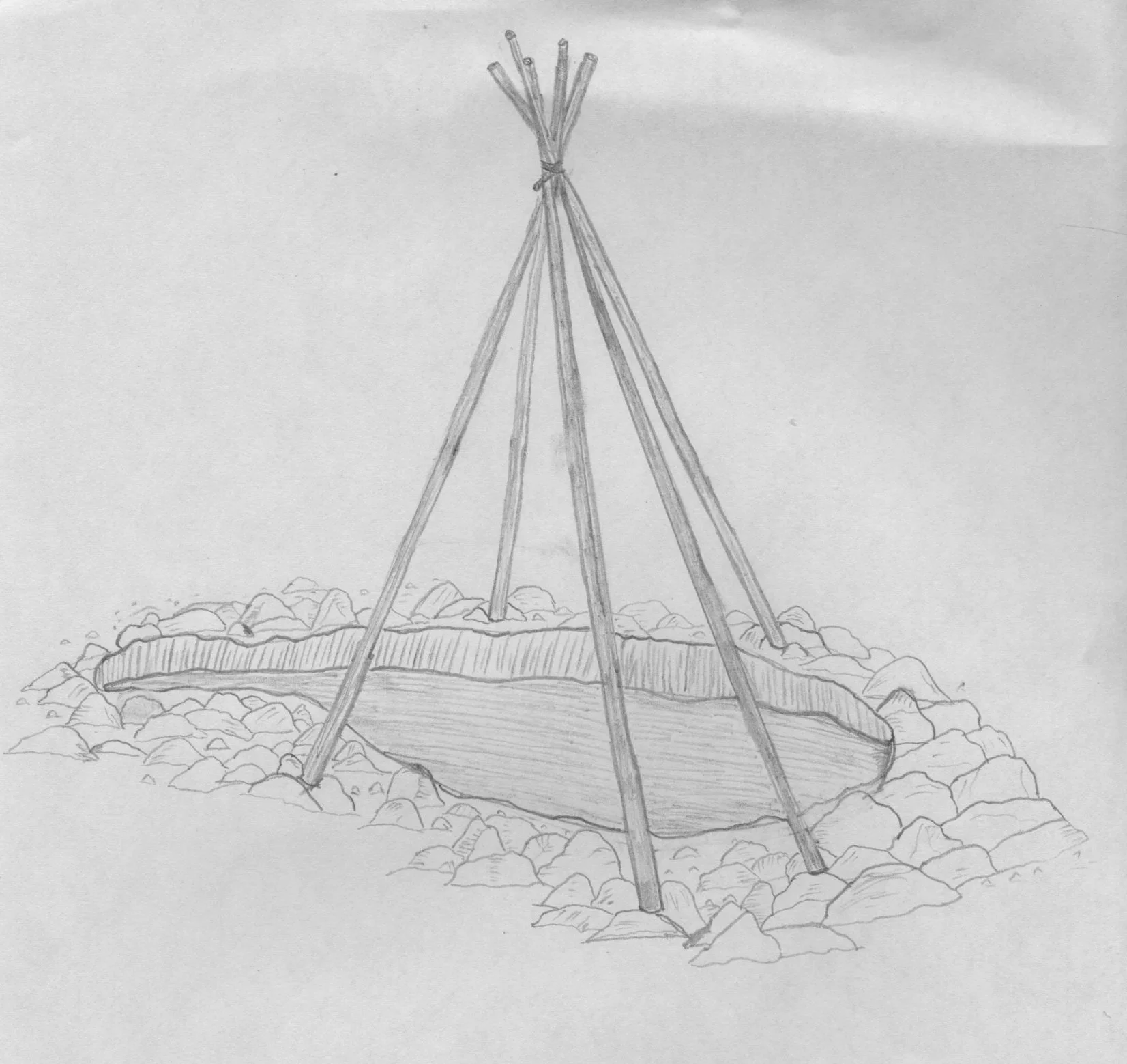
Redrawn image of the structure showing remnant semi-subterranean outline
The recovery of the amazing artifact (i.e. polished grooved gouge) in close proximity to the rocky outline possible structure heightened the need to carry out further investigations of this site. Unfortunately, the 1991 discovery of the possible structure happened during a period of time when water levels were unusually low. The entire cobbled area of shoreline requiring further investigation was inaccessible because normal water levels for the lake (even during early spring) are much higher than they were in 1991. Therefore, most of the time the site the site is completely submerged so a return visit to do additional investigations was delayed until some point in the future.
It is important to note that, prior to the 1934 flooding of the lake for the purposes of hydro-electric generation, the cobbled area encompassing the oval shaped feature (structure outline) would have been situated within the forest at an elevation above the pre-flood high water line. Examination of aerial photos taken in 1928 (curated in the National Aerial photo library in Ottawa) and compared to near aerial pictures taken in 1997 indicate the degree of shoreline disturbance that has occurred over a period of 60 plus years.

White arrows show location of structure within aerial photos as follows: (left) 1928 pre-flood aerial photo and (right) 1997 near aerial photo captured by Brad Hyslop
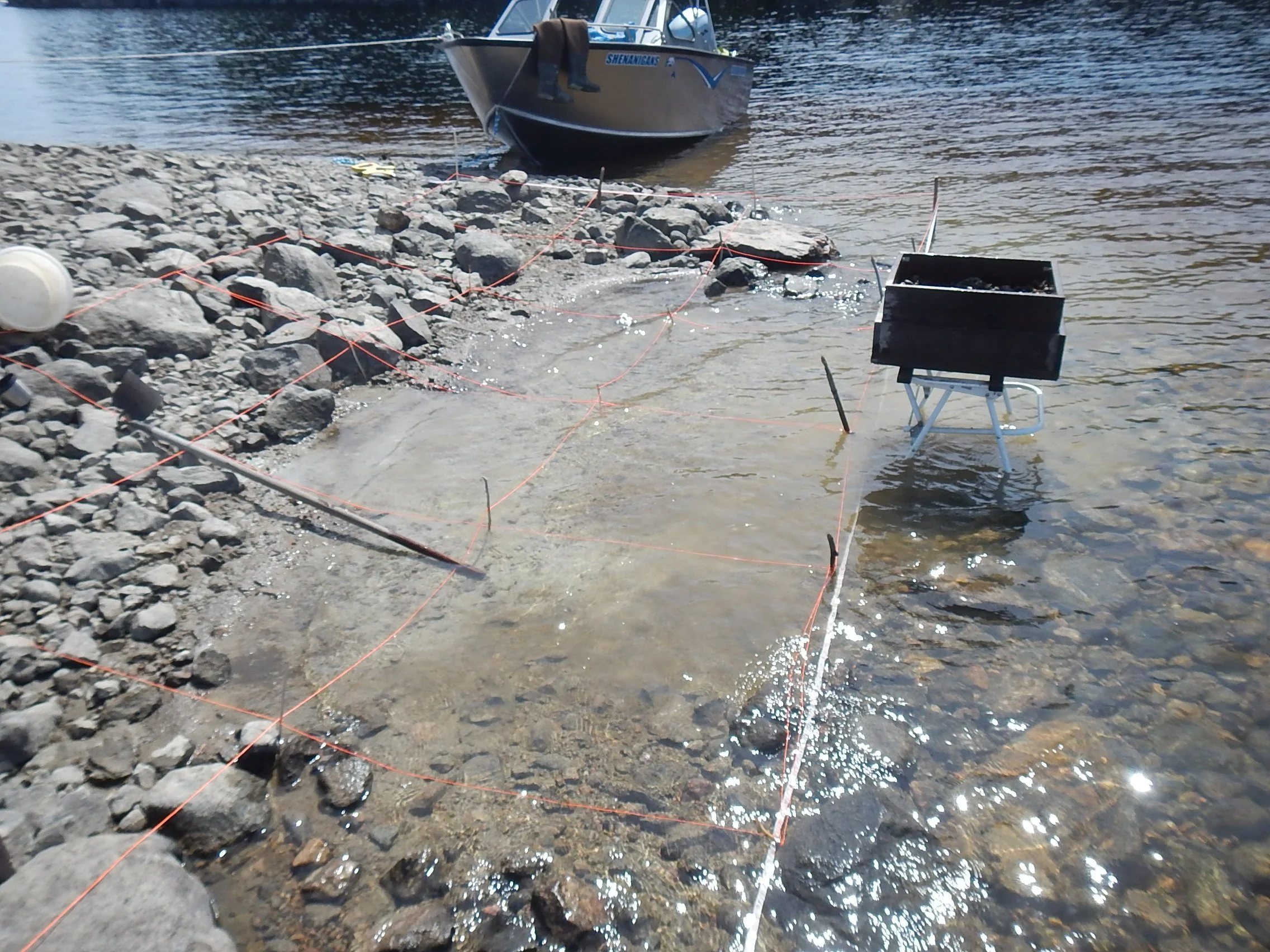
In May of 2003, I embarked on an early spring archaeology expedition up Lac Seul. The water levels on the lake were exceptionally low at the time due to drought conditions over the winter. As I drove past EaKa-34 I noticed that the typically submerged area of shoreline containing the rock outline of the possible structure was exposed, so I navigated the boat over to the site and pulled into shore.
2003 photo showing possible structure outline with white arrow showing 1991 gouge location
2003 photo alternate view showing possible structure outline within cobble shoreline
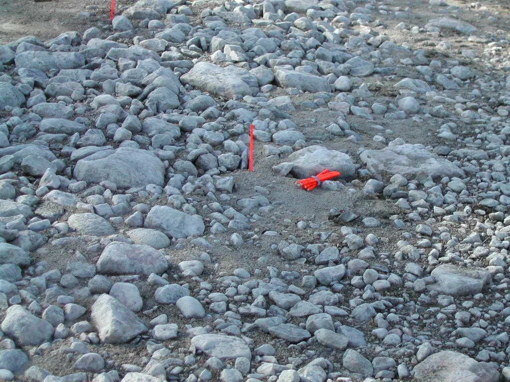
I placed fluorescent orange spray painted pencils along the edges to mark the area contained within the rock outline in order to document and photograph the feature. I also carefully examined the exposed shoreline to search for any additional cultural material that may have been exposed at the site. While measuring and examining the cobbles encircling the feature, I spotted an object embedded within the rocks not far away from where the grooved gouge was discovered in 1991. To my surprise (and great delight) nestled into the ground beside some medium and smaller sized boulders on the exterior edge of the structure outline, I found another grooved gouge!
In-situ location of gouge discovered within cobbles in May 2003
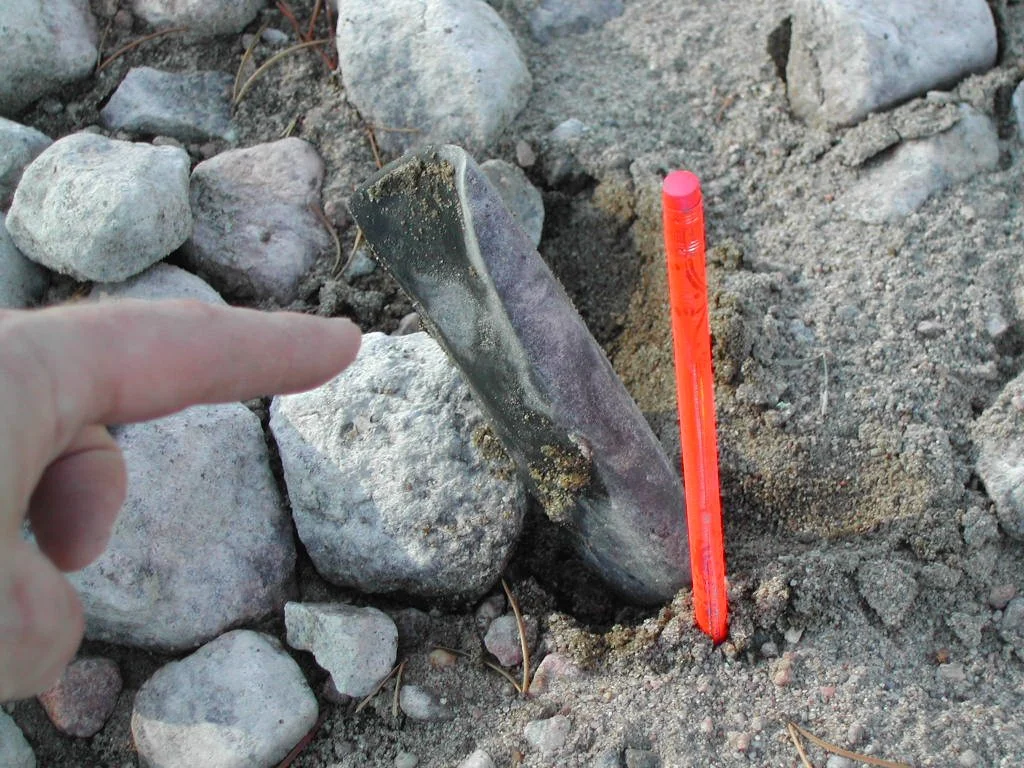
Close up in-situ view of grooved gouge discovered in May 2003
This was the second grooved gouge from the site. (To view additional images and/or to access 3-D links of this artifact click this link Two More Grooved Gouges.) An amazing find and, although I was only one hour into my trip, I had already made the discovery of the expedition! However, I did eventually boat away from this site to investigate other locations further up the lake.

Overview of structure outline in relationship to grooved gouges discovered
Several weeks later, I spent a Sunday afternoon in July boating around the lake checking on some sites within the EaKa borden zone. This was because water levels, although rising through May and June, had only increased slightly and remained historically low due to persisting drought like conditions. I decided to make a stop at EaKa-34 to have a quick look around. While at the site I discovered a stone object that, although unfinished (as in not polished), is likely in the process of becoming a third grooved gouge! For additional details and photographs of this artifact, please navigate to the cool discoveries section of this website and click on Two More Gouges or click this link). With my thoughts more focused having recovered three grooved gouges from within a fairly small area at one site, no additional research of the remnant structure (partially submerged at this point) was carried out.
However, with so little known about the structures utilized by Indigenous cultures who lived within the boreal forest during the pre-contact time period, I would occasionally think about the remnant structure outlined within the cobble rocks at EaKa-34. But, as it turned out, several years passed before I had the opportunity to visit the site (at a time when the water levels were low enough to have access to the structure outline). In early May of 2017, although the water levels were not low enough to completely expose the feature, I was finally able to carry out additional research at the site.
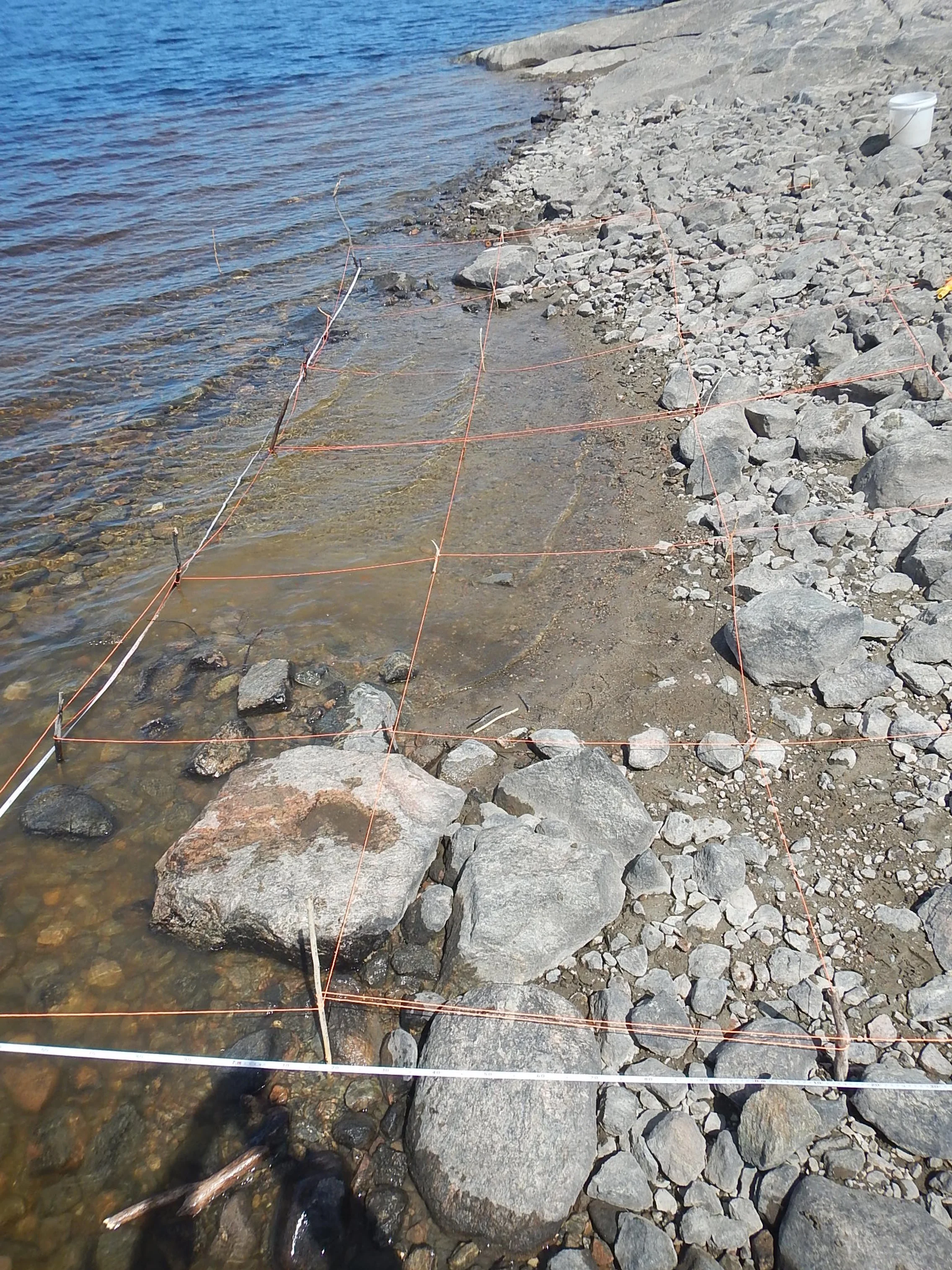
May 2017: Grid overlay in one meter units over structure

Graphed sketch of structure laid out within grid overlay
I mapped out the area encompassed within the feature and placed a measured grid across the rock outline. After graphing a sketch (to scale) of the structure, I selected a unit (one square meter in size) removed soils and screen them. The results of this activity were less than remarkable as the fine grained beach soils represented only a thin veneer on top of hard packed clay. It is likely that, after several decades of being subjected to multiple submergence-exposure cycles and the wave action that occurred during these events, the soils pertaining to the living floor of the feature have been washed out.
Soil matrix within structure outline has been washed away
All material captured within the 1/8 inch screen was retained but nothing clearly diagnostic was recovered. Further analysis back at the lab was equally inconclusive as, although some smaller sized angular quartz items were within the material collected, none of the objects could be definitively classified as anthropogenic (i.e. modified by human activity).
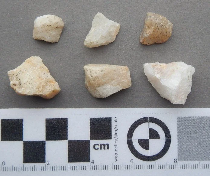
Quartz small sized debitage recovered in screen
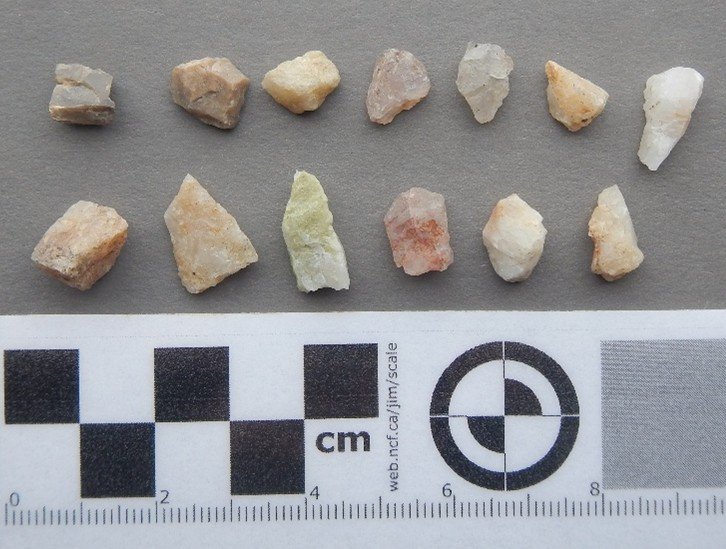
Quartz and other tiny sized debitage recovered in screen
Three days later I was able to revisit the site accompanied by staff members from Lakehead University. In addition to showing them the structure and having a few more sets of eyes to search the eroded shoreline for any exposed cultural material (none observed), I had the good fortune to have Scott Hamilton bring his drone to fly over the area and get a different viewpoint of the feature. Dr. Hamilton has been experimenting with and teaching students about drone technology as an analytical tool for use on archaeological sites for many years. To read more about the use of drones in archaeology click the link to view the 2016 paper Testing UAV (drone) aerial photography and photogrammetry for archaeology (courtesy of Dr. Scott Hamilton).

Left to right: Martha Dowsley, Scott Hamilton and Clarence Surette

Scott Hamilton launching drone flight over structure
As seen within the images captured from the drone flight at the EaKa-34 site in May of 2017 (images and drone flight courtesy of Dr. Scott Hamilton) valuable information can be gleaned. Further details regarding the documentation of this feature are contained within a co-authored poster presented at the 2018 CAA conference in Winnipeg, Manitoba. To view this poster click on the following link: Documenting a possible house feature along the severely eroded shore of Lost Lake, Lac Seul basin. From an aerial viewpoint the structure is even more obvious than it is from the ground. Furthermore, the amount of eroded material that has been washed away from the cobbled area (of what is now the shoreline) is even more apparent. It appears that the lighter and finer grained clays and sand have been displaced to create a depositional fan tail south and southwest of the structure. These soils are now situated along a moderate slope that runs away from the cobbled plateau and into much deeper waters. I can’t help but wonder if there are more grooved gouges to be discovered within that matrix!
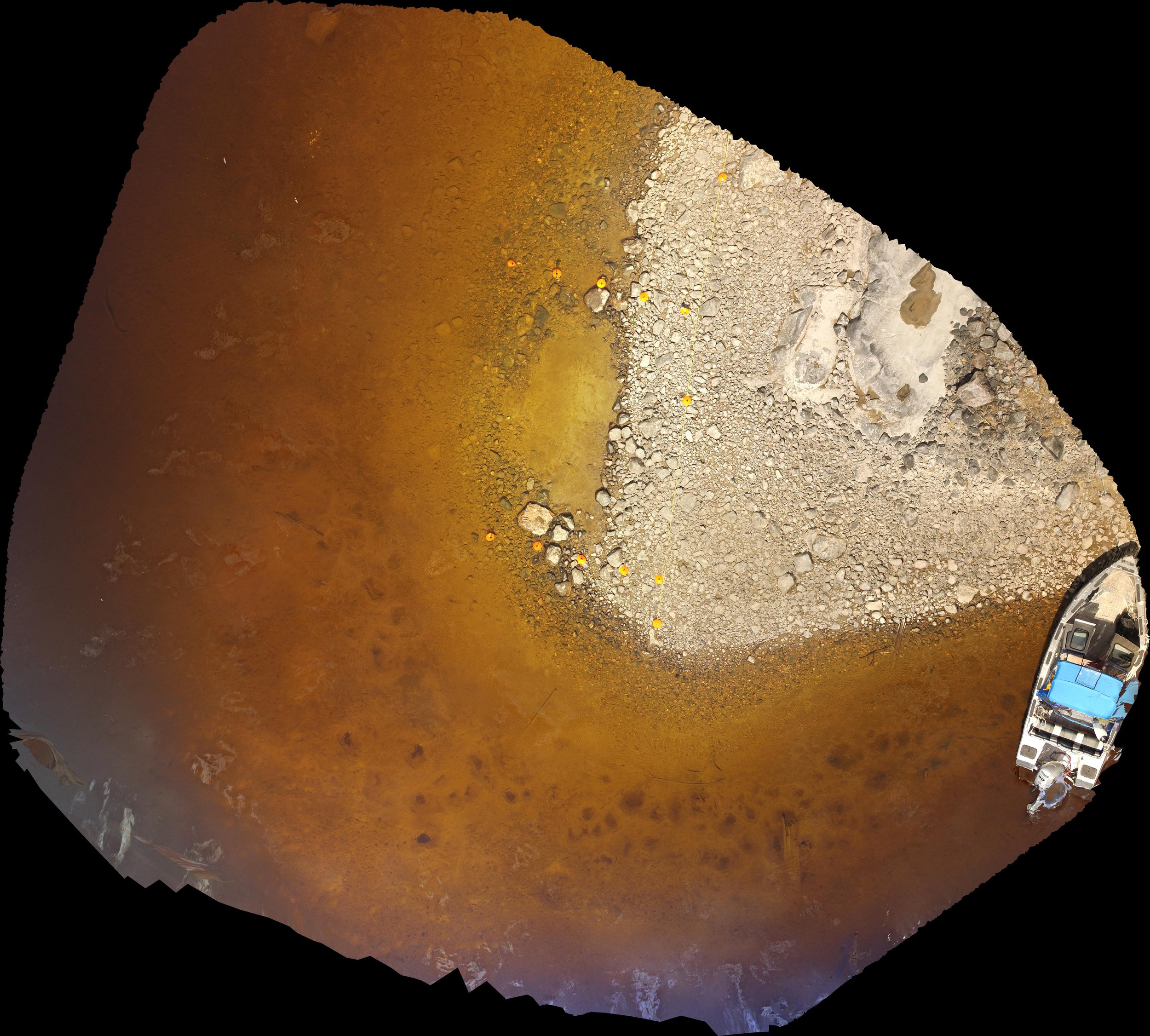
Imagery captured from drone flight over structure area

Digital Elevation Model (DEM) of structure area
As mentioned previously, there is very little data pertaining to the structures created and utilized by pre-contact Indigenous groups who resided within the boreal forest. One of the issues confronting archaeologists on this matter is visibility. Dwellings constructed in the forested area are swallowed up in less than a hundred years (let alone thousands of years) by the ongoing growth and regeneration of trees and other vegetation. Visually locating former structures in the boreal forest is virtually impossible. One future possibility is to have high resolution lidar equipped drones conduct low level flights at optimum times of the year (early spring or fall) when vegetation cover is at a minimum. However, the remnants of the structure at Eaka-34 give as a hint on the possibilities of what may lay beneath and potentially revealed in future years.